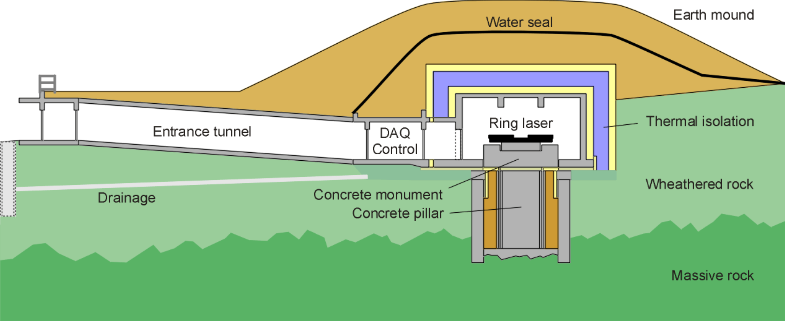
Located in lab five meters below ground level, the ring laser of the geodesy observatory Wettzell is anchored in a solid concrete pillar, which extends six meters down into the solid rock of the Earth’s crust. It is insulated from above with layers of Styrodur and clay, and topped by a four-meter high mound of Earth. Scientists have to pass through a twenty-meter tunnel with five cold storage doors and a lock to get to the laser.